Application of CFD and MCDM in Flood Prediction
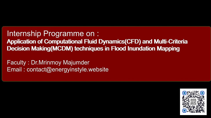
Call for Internship : An internship program where we want to use CFD and MCDM techniques to predict the impact of flooding in a watershed by mapping the area that can be inundated by flood.
Computational Fluid Dynamics (CFD) is used in flood prediction to simulate the complex flow dynamics of water in rivers and floodplains, allowing researchers and engineers to accurately predict flood inundation areas, water depths, and flow velocities, which can be crucial for early warning systems, mitigation strategies, and infrastructure design in flood-prone regions(Ref).
Title of the Internship :
Application of Computational Fluid Dynamics(CFD) and Multi-Criteria Decision Making(MCDM) techniques in Flood Inundation Mapping
Key applications of CFD in flood prediction:
In the field of hydrology, Computational Fluid Dynamics (CFD) is not used frequently. However, when it is used, it serves the following applications:
Detailed flow analysis:
CFD models can capture intricate details of water flow, including turbulent effects, water surface profiles, and interactions with obstacles like bridges and buildings, providing a more comprehensive understanding of flood dynamics than simpler models(Examples).
Flood inundation mapping:
By simulating water levels across a geographical area, CFD can generate detailed inundation maps, identify areas at high risk of flooding, and help prioritize mitigation efforts(Examples).
Impact of infrastructure modifications:
CFD can be used to assess the impact of proposed flood control structures like levees, floodwalls, or drainage systems on water flow and inundation levels, allowing for optimized design and placement(Example).
Extreme flood scenarios:
CFD can simulate extreme flood events, like sudden dam breaks or rapid snowmelt, to understand potential worst-case scenarios and plan appropriate emergency response strategies.
Urban flood modelling:
By incorporating complex urban features like drainage networks and buildings, CFD can accurately simulate urban flooding, helping to identify areas with poor drainage and potential flooding hotspots(Example).
Significance of Applying CFD and MCDM in Flood Inundation Mapping
The significance of Computational Fluid Dynamics (CFD) and Multi-Criteria Decision-Making (MCDM) in flood inundation mapping is delineated below. Although Computational Fluid Dynamics (CFD) and Multi-Criteria Decision Making (MCDM) are utilized in various flood-related studies, they have not been integrated. But why is this integration important? CFD lacks the ability to segregate variables based on their role in flood prediction and cannot generate maps that provide information about the extent of potential flood damage. On the other hand, when MCDM and Geographic Information Systems (GIS) are integrated with CFD, these limitations can be addressed effectively.(Please go to the end of the article for the sources from where the data is collected).
Computational Fluid Dynamics (CFD)
CFD models are used to accurately forecast flood dynamics, enabling inundation zone mapping and comprehensive flood risk assessments. They are useful for training rescue staff and are being developed to enhance accuracy and computational efficiency. 3D CFD simulations are essential for communicating flood risks to the public and authorities. CFD is particularly useful in dam-break modelling, which helps predict the consequences of potential dam failures or breaches during storms. Researchers have used 3D hydrodynamic models to simulate real-world flooding scenarios, helping to choose suitable models for dam-break analysis. CFD can also assess the convergence of numerical solutions using techniques like the Grid Convergence Index (GCI). The Integrated River and Ocean Modelling System (IROMS) model simulates surge propagation in both ocean and inland areas, particularly useful for studying combined storm surge and inland flooding events triggered by cyclones. CFD models can be coupled with weather forecast models to continuously analyze flood processes and entropy theory to improve understanding of river systems and optimal sensor positioning(Please go to the end of the article for the sources from where the data is collected).
Multi-Criteria Decision-Making (MCDM)
MCDM is a valuable tool for flood susceptibility mapping when integrated with Geographic Information Systems (GIS). It involves weighting and overlaying various flood causative factors to generate susceptibility maps. The Analytical Hierarchy Process (AHP) is a commonly used method for determining the weights of different criteria and ranking flood-influencing factors. MCDM techniques, when combined with GIS and remote sensing data, can identify flood-prone areas and delineate floodplains. Integrating MCDM with flood inundation models in a GIS environment allows for a more accurate representation of flood hazard probabilities in specific locations. Methods that account for spatial variability are considered more effective in generating flood hazard maps. MCDM can be applied to identify suitable sites for flood rehabilitation shelters, supporting disaster management efforts. It contributes to informed decision-making, enabling targeted interventions like improving drainage, establishing early warning systems, and prioritizing rehabilitation efforts.(Please go to the end of the article for the sources from where the data is collected).
The existing literature emphasizes the significance of integrating CFD and MCDM with other technologies, like GIS and remote sensing, for comprehensive flood inundation mapping and risk assessment. These approaches help understand flood dynamics, predict potential inundation zones, and support efficient disaster management strategies.
Limitations Highlighted in the Existing Literature
The previous studies(Please go to the end of the article for the sources from where the data is collected) identify several limitations and gaps in the existing research on flood modelling and flood risk management, particularly regarding data availability, model capabilities, and the integration of different approaches.
Data Availability and Quality
Flood modelling in developing countries faces significant challenges due to a lack of quality and readily available datasets, a critical gap in understanding spatial and temporal variations of key hydrological components, and limited access to advanced technologies like remote sensing. This lack of detailed information on flood frequency analysis and extent hampers the accuracy of flood inundation estimations. High-resolution data for calibrating and validating flood models is often limited, particularly for three-dimensional models. Acquiring such data remains a challenge for developing countries, hindering the full utilization of remote sensing technology for model calibration. Despite advancements in data acquisition, there is limited technical capacity in developing countries to access and utilize these datasets effectively. This constraint hampers the accurate assessment of the human, environmental, and economic impacts of pluvial flood inundations in developing countries.(Please go to the end of the article for the sources from where the data is collected).
Model Capabilities and Limitations
Existing flood models, particularly one-dimensional models, have limitations in their representation of hydrological processes and cannot accurately simulate urban flooding in developing countries. These models oversimplify flood hydraulics, leading to inaccurate representations of urban flooding scenarios. Despite advancements, numerical schemes used in flood models have not achieved the accuracy needed to predict flood inundation across diverse urban environments. Research on the suitability of different numerical schemes for developing countries is limited, highlighting a gap in understanding their applicability.
The applicability of existing flood models in data-scarce locations is often constrained, highlighting the need for bespoke models relying on easily accessible datasets. Validation of existing flood models often lacks comprehensive analysis of spatial variations in surge inundation, particularly for regions like the Bay of Bengal.
Influencers of flood models, such as bed topography resolution, also have inherent uncertainties that affect the accuracy of predictions for complex scenarios like dam breaks. Simplified flood models like kinematic, diffusive, and inertial wave equations offer advantages in terms of reduced computation time and stability, but need further enhancement to demonstrate their effectiveness in developing countries.
Existing numerical models cannot effectively evaluate the impact of future scenarios, such as climate change, on flood risks. There is a need for a comprehensive analysis of the interrelationships between different flood criteria, as current machine learning-based models may not always outperform MCDM methods.(Please go to the end of the article for the sources from where the data is collected).
Integration of Approaches
The integration of CFD and MCDM with other technologies like GIS and remote sensing is crucial for flood inundation mapping and risk assessment. Limited research exists on digital twin technology for flood risk management. Uncertainty and sensitivity analyses are essential for evaluating model performance and adapting models to developing countries. Further investigation is needed to develop robust procedures aligned with flood models. A bespoke flood model is needed to overcome data and science challenges in economically disadvantaged areas.(Please go to the end of the article for the sources from where the data is collected).
The previous studies(Please go to the end of the article for the sources from where the data is collected) suggest that addressing these limitations and gaps is essential for advancing flood modelling and risk management, particularly in data-scarce regions like developing countries.
Research Gap/Future Scope of Research
Future research should focus on:
Improving data availability and accessibility through investments in data infrastructure, capacity building, and promoting open data initiatives.
Developing advanced models that can accurately represent complex hydrological processes and urban environments, even with limited data.
Integrating different modelling approaches, including CFD, MCDM, GIS, and remote sensing, to create comprehensive and robust flood risk management frameworks.
Validating models against a wider range of real-world scenarios, including those involving spatial variations in surge inundation and future climate change impacts.
Exploring the potential of emerging technologies like digital twins to enhance flood modelling and decision-making processes.
Internship Objective
The primary objective of this internship is to utilize Computational Fluid Dynamics (CFD) for flood inundation mapping. In addition to CFD, we will integrate Multi-Criteria Decision-Making (MCDM) techniques such as PROMETHEE, AHP, and MERC as suggested in the third research gap or future scope of research(see previous subheading). A solid understanding and proficiency in CFD are required to successfully pursue this internship, which can be completed in either online or offline mode.
Internship Duration
2 month
Internship Schedule
Throughout the Year
Internship Outcome
Certificate of Success
Journal/Conference Publication(Based on performance)
If you are interested in participating in this internship kindly contact at the following email or chat with me from the link below: contact@energyinstyle.website.
If you are planning to launch your own internship program, please email me at contact@energyinstyle.website. Your internship opportunity will be featured in this newsletter and on our website: https://energyinstyle.website/.
Simplify website creation with AI(AD)
Click here to Upgrade and access the above content for more than beyond the initial seven days. (Free members can access the content only for seven days after each post is published.) But Paid / Personal Members have no such restrictions. It costs only Rs.600 per year to become a paid member.
If you are a representative of a Lab or Research Group then purchase the Group Membership and if you are an entrepreneur or representing an institute, procure the Institute / Founder Membership.
This will allow the entire group or organization to access the paid content of the Baipatra VSC newsletter for free, along with all the other benefits offered to Paid or Personal members.
If you want to pay the membership fees in USD then do so by clicking here
Embrace the opportunity to learn about Artificial Intelligence, Flood Prediction, Water Resource Management, and more by clicking here.. You may also promote and earn money selling educational products by becoming an affiliate of Innovate S : our digital shop.
The information provided above is presented in the order in which it was received from the source. The application link and dates are the same as those that were provided by the source. Shared knowledge is based on what is received. the author of this post and HydroGeek are not liable for any liability or damage resulting from the use of this information. Additionally, our Terms and Conditions, Cancellation and Refund Policy as well as our Privacy Policy are presented here for your perusal. After taking into account the honorarium and the cost of maintenance, the amount that is obtained in exchange for the membership fee or through any other methods, if any, is then donated to non-profit organisations.
Festival Offers going on in AJIO (AD)
Full Reference/Sources :
Keep reading with a 7-day free trial
Subscribe to Baipatra VSC to keep reading this post and get 7 days of free access to the full post archives.


